Kanchenjunga Circuit Trek
Beyond the familiar trails, into the heart of the eastern Himalayas.
Trip Overview
- Best season
- Spring · Autumn
- Group size
- 2 – 12 People
- Start & end
- Kathmandu
Highlights
- Two Sides of Kanchenjunga Visit Pangpema on the northern side and Oktang on the southern side to experience two distinct perspectives of the world's third-highest mountain.
- Pangpema — North Base Camp Reach approximately 5,143 m and take in the enormous northern face of Kanchenjunga, surrounding peaks and glacial terrain.
- Oktang and the Yalung Glacier Walk to the southern viewpoint at approximately 4,730 m for views of Kanchenjunga's southern face and the surrounding glacier system.
- Remote Himalayan Villages Pass through settlements such as Ghunsa, Kambachen and Lhonak, where life continues at the pace of the mountains.
- High Mountain Passes Cross the high passes connecting the northern and southern valleys, including the Sele Le and Mirgin La pass system. The crossing is one of the trek's most physically demanding sections.
- Tibetan Buddhist Culture Discover traditional stone houses, prayer flags, mani walls and Buddhist monasteries in the upper mountain settlements.
- Changing Landscapes Walk from subtropical river valleys and forested hills to alpine pastures, rocky moraines and glacial terrain.
- A Quieter Himalayan Experience Explore a remote trekking region that receives considerably less traffic than Nepal's best-known routes.
About this trek
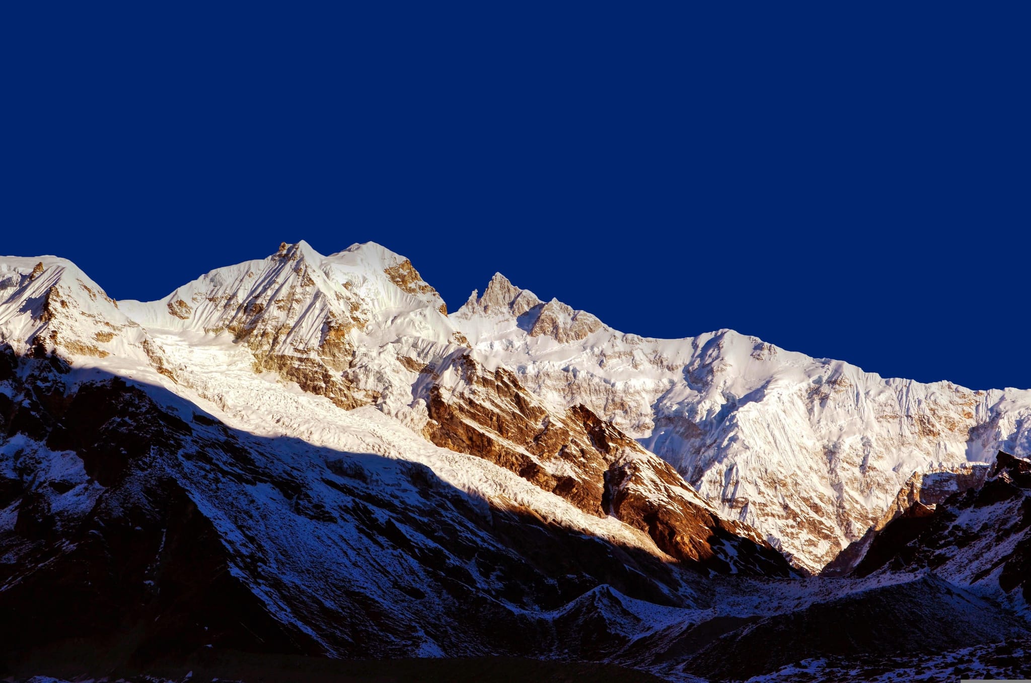
The Kanchenjunga Circuit Trek is a demanding journey through one of Nepal's most remote Himalayan regions, circling Mount Kanchenjunga (8,586 m), the world's third-highest mountain. The route takes you through forested valleys, traditional mountain villages, alpine meadows and glacial landscapes before reaching the northern base camp area at Pangpema and the southern viewpoint at Oktang.
The trek begins in the lower valleys of eastern Nepal, where terraced fields, rivers and forested hills gradually give way to high mountain terrain. As you ascend the Ghunsa Valley, you pass through traditional settlements such as Ghunsa and Kambachen, where Tibetan Buddhist culture remains an important part of everyday life. Above the villages, the landscape becomes increasingly rugged, with glaciers, rocky moraines and dramatic mountain faces.
The northern section leads to Pangpema (5,143 m), where the immense northern face of Kanchenjunga dominates the surrounding landscape. From there, the trail returns through Ghunsa before crossing the high passes connecting the northern and southern valleys. The journey continues to the Yalung Valley, where Oktang (4,730 m) offers an impressive viewpoint of the southern face of Kanchenjunga and the Yalung Glacier.
Unlike Nepal's busier trekking routes, the Kanchenjunga Circuit offers a stronger sense of remoteness, with fewer trekkers, basic mountain lodges and long stretches of wilderness. It is best suited to experienced trekkers who are prepared for long walking days, high altitude and changing mountain conditions.
Join Junkiri Treks to explore both sides of Kanchenjunga, experience the cultural life of eastern Nepal's mountain communities and discover one of the Himalayas' great wilderness routes.
Day by Day Itinerary
Welcome to Nepal. Upon arrival at Tribhuvan International Airport, our representative will meet you and transfer you to your hotel. The rest of the day is free to rest after your journey or explore the surrounding area at your own pace.
In the evening, meet your trekking guide for an introduction to the Kanchenjunga Circuit Trek. You will discuss the route, travel arrangements, equipment, and any final preparations.
Today is reserved for final preparations before heading to eastern Nepal.
You may have time to visit a few cultural sites in Kathmandu, depending on your interests and preparation schedule. In the afternoon, your guide will review your trekking equipment and check that you have the clothing and supplies needed for cold conditions at high altitude. He will also explain the restricted-area requirements and the importance of following the itinerary, particularly during acclimatisation and the high-pass crossing.
Take an early flight from Kathmandu to Bhadrapur in southeastern Nepal. From here, continue by road towards Taplejung, passing through the eastern hills and tea-growing landscapes around Ilam, subject to the chosen road route and conditions.
The drive is long and takes between 8-10 hrs. The landscapes change as the road climbs away from the plains. Arrive in Taplejung and settle into your accommodation. If flight schedules or road conditions make the journey too long, an additional overnight stop may be necessary.
After breakfast, travel by local jeep towards Sekathum, following rough mountain roads through remote settlements and river valleys. Road conditions can be uneven, and journey times vary with weather and maintenance.
Sekathum is the starting point for the main trekking section. After arrival, organise your gear, meet any supporting crew, and prepare for the first walking day.The trek begins by following the Ghunsa Khola through a narrow, forested valley. The trail crosses suspension bridges and climbs through bamboo, oak, and other subtropical vegetation. Some sections are steep, with repeated ascents and descents above the river..
As you gain altitude, the settlement becomes smaller and the landscape more remote. The final climb leads to Amjilosa, a small settlement above the valley.
Continue north along the Ghunsa Khola, climbing through dense forest and passing waterfalls and small clearings. The trail is undulating, with a mixture of uphill sections and short descents.
As you approach Gyabla, the valley begins to open, and Tibetan Buddhist cultural influences become more noticeable. Gyabla is a small settlement where you can rest and prepare for the next day's climb to Ghunsa.
Today, the trail climbs towards Ghunsa, the largest permanent settlement in the upper valley. Walk through forested slopes and pass Phale, a settlement associated with Tibetan-speaking communities, before continuing towards Ghunsa.
The landscape gradually changes as you gain altitude, with coniferous forest replacing much of the lower-valley vegetation. Ghunsa has several teahouses and a more established village atmosphere than the settlements you have passed so far.
Spend another night in Ghunsa to help your body adjust to the increasing altitude. After breakfast, you may take a short, gradual walk above the village, following your guide's advice, before returning to the same accommodation.
The rest of the day is for rest, hydration, and exploring the village at an easy pace. Your guide will monitor how everyone is feeling before the trek continues towards 4,000 m.
Leave Ghunsa and follow the trail farther into the upper valley. The route passes through coniferous forest before entering more open alpine terrain, with increasingly expansive views of the surrounding mountains.
Some sections may cross unstable slopes or areas affected by landslides, so follow your guide's instructions and maintain a steady pace. As you approach Kambachen, the impressive north face of Jannu, also known as Kumbhakarna, becomes a major feature of the landscape.
A second acclimatisation day provides additional time to adjust before ascending towards Lhonak and Pangpema. If conditions and your physical condition allow, your guide may lead an optional walk to a nearby viewpoint overlooking the surrounding mountains and glacial landscape.
Return to Kambachen for the night. Keep the day relaxed and avoid unnecessary exertion. Any headache, nausea, dizziness, unusual fatigue, or breathing difficulty should be reported to your guide immediately.
Continue through the upper Kanchenjunga valley, where the landscape becomes increasingly rugged and exposed. The trail follows glacial terrain and rocky slopes, with sections that may be affected by loose stones or landslides.
Vegetation becomes sparse, and the surrounding mountains and glaciers dominate the view. The final approach to Lhonak leads to a remote settlement used as the overnight base for the North Base Camp excursion. Because you will be sleeping at a higher altitude, walk slowly and allow enough time for rest breaks.
Today is one of the main highlights of the trek. Set out early from Lhonak and follow the trail towards Pangpema, the North Base Camp area of Kanchenjunga. The route crosses rugged terrain beside the glacier, with views of the enormous mountain walls and surrounding peaks.
The walk is demanding because of the altitude, exposed conditions, and distance. Your guide will assess the weather and the group's condition before deciding how far to proceed. If conditions permit, spend some time at Pangpema before returning along the same route to Lhonak.
Retrace the trail through the upper valley, descending from Lhonak towards Kambachen. Although much of the route follows familiar terrain, the descent can still require care on rocky and uneven sections.
The lower altitude may make walking feel more comfortable, but take your time and watch your footing. On arrival in Kambachen, rest and enjoy the mountain surroundings.
Continue descending towards Ghunsa, retracing the trail through alpine terrain and forested slopes. The route offers another opportunity to appreciate the changing landscape as you leave the higher glacial valley.
After reaching Ghunsa, take a well-earned rest. This is also an opportunity to check equipment and prepare for the crossing towards the southern side of the Kanchenjunga massif.
Leave the main northern valley and climb towards Sele Le Kharka, the staging point for the high-pass crossing. The trail rises through forest before reaching more open alpine terrain.
The ascent is steady and can feel demanding as the altitude increases. Depending on the exact route and current trail conditions, the overnight stop may be described as Sele Le Kharka or a nearby high camp. Facilities are basic, and cold conditions are possible even during the main trekking seasons.
Rest well and follow your guide's instructions for an early start the following morning.
This is one of the most demanding days of the circuit. Start early and cross the high passes connecting the northern and southern sides of the Kanchenjunga region. Depending on the exact line followed, the route may include the Sele La, Mirgin La, Sinion La, and Sinelapche La pass system.
The trail passes through exposed high-altitude terrain, with expansive views of the surrounding Himalayan peaks when the weather is clear. Snow, ice, strong winds, and poor visibility can make the crossing more difficult, so the final route and pass sequence must be confirmed by your guide.
After crossing the high ground, descend towards Tseram in the Simbuwa Khola valley. This is a long day, and safe completion depends on weather, trail conditions, and the group's pace.
From Tseram, follow the valley towards Ramche, gradually gaining altitude through open alpine terrain. The landscape becomes increasingly stark, with rocky slopes, glacial features, and mountain views.
Ramche serves as a base for exploring the Oktang viewpoint on the southern side of Kanchenjunga. Keep the pace steady and take care as the trail gains elevation.
Today, walk towards Oktang, the viewpoint commonly visited as part of the South Base Camp section of the trek. The route follows the upper valley towards the Yalung Glacier area, offering close views of the surrounding peaks and the southern face of the Kanchenjunga massif.
The terrain is rocky and exposed, and the altitude makes the walk more demanding than the distance alone suggests. Spend time at the viewpoint if weather and conditions allow, then return to Ramche for another night.
Retrace the route from Ramche to Tseram, descending through the upper valley. The lower altitude provides a welcome change after the high-altitude excursions of the previous days.
Enjoy the mountain scenery along the way and take care on rocky sections. After reaching Tseram, relax and prepare for the descent through forested terrain towards the southern settlements.
Descend from Tseram towards Tortong, following the trail through the Simbuwa Khola valley. The route passes through forested areas, with a noticeable change in vegetation as you lose altitude.
Some sections can be steep and slippery, particularly after rain or snowfall. Take care on the descent, as tired legs can make uneven terrain challenging. Arrive at Tortong and settle into the accommodation available for the night.
Continue descending through the southern side of the Kanchenjunga region. The trail passes through forest and remote settlements before reaching Yamphudin, one of the important villages on the southern exit route.
The day's walk includes further changes in altitude, vegetation, and local culture. Yamphudin is a useful stopping point before the journey by road back towards the eastern hills.
Continue along the southern trail towards Khebang, passing through rural settlements and cultivated hillsides. This section provides a glimpse of everyday life in the eastern hills, away from the high mountain environment.
The trail may involve repeated ascents and descents rather than a continuous downhill walk. Your guide will confirm the actual overnight stop according to the current trail condition, walking pace, and local accommodation.
After completing the trekking section, meet your vehicle at the agreed pickup point and begin the road journey towards Bhadrapur. Depending on the roadhead and road conditions, the drive may require an overnight stop en route.
The journey passes through the eastern hills and lower valleys, gradually returning towards the Terai. This is a transfer day rather than a sightseeing day, so allow flexibility for road delays.
Transfer to Bhadrapur Airport for your flight to Kathmandu, subject to the airline schedule and weather conditions. On arrival, transfer to your hotel and enjoy some free time.
This day also provides flexibility if the previous road journey takes longer than expected. Domestic flights in Nepal can be affected by weather and operational changes, so avoid scheduling an international departure too close to this flight.
Your Kanchenjunga Circuit Trek comes to an end today. Depending on your flight schedule, you will be transferred to Tribhuvan International Airport for your onward journey.
If you have extra time in Nepal, you can extend your stay with a cultural tour, a visit to Pokhara, or a short trip to Chitwan.
Route & Elevation
Trip Map
22 stops · 16 places · 91–5,143 m
Kathmandu
1400m
Bhadrapur-Taplejung
91 m | 1820mDrive
Sekathum
1660mDrive
Amijilosa
2510m
Gyabla
2730m
Ghunsa
3590m
GhunsaNight 2
3590m
Kambachen
4050m
Lhonak
4780m
North Base Camp-LhonankHigh
5143m | 4780m
- Return
KambachenReturn
4050m
GhunsaReturn
3595m
Sele La Kharka
4290m
Tseram
3870m
Ramche
4580m
RamcheNight 2
4580m
TSeramReturn
3870m
Tortong
3100m
Yamphudin
2800m
Khebang
1960m
Bhadrapur
91mDrive
KathmanduReturn
1400mDrive
Elevation
Photographs
Good to Know
Permits, insurance, altitude and the rest of the small print.
The Kanchenjunga Circuit combines the northern and southern approaches to Mount Kanchenjunga. The main route begins with road travel towards Sekathum, climbs the Ghunsa Valley to Pangpema, returns to Ghunsa, crosses the high passes into the southern valley and continues towards Yamphudin and the road network.
Road construction and changing access can affect the starting point and length of the lower walking sections. The final itinerary should be confirmed with local guides before departure.
The journey normally begins with a flight from Kathmandu to Bhadrapur, followed by a road transfer towards Taplejung and the trekking trailhead.
Depending on the road conditions, the journey may require an overnight stop. Allow sufficient time for delays and avoid scheduling a tight international connection immediately after the return journey.
Junkiri Treks uses public transportation where practical to reduce the environmental footprint. Private vehicles can be arranged on request at an additional cost, subject to availability.
Most international visitors require a valid Nepal tourist visa. Eligible travellers can obtain a visa on arrival at Tribhuvan International Airport, subject to current immigration rules.
Check the latest visa requirements, fees and eligibility before travelling. Carry your passport and relevant travel documents.The Kanchenjunga region includes restricted areas and a conservation area. Foreign trekkers need the applicable restricted-area trekking permit and Kanchenjunga Conservation Area entry permit.
Permits should be arranged through an authorised trekking agency before the trek begins. Current regulations also require compliance with the applicable guide and group rules.
Permit fees and documentation requirements can change. Junkiri Treks will confirm the applicable requirements before departure.
Spring (March–May): Spring brings warmer conditions, flowering rhododendrons in the lower forests and generally favourable trekking opportunities. Snow can remain on high passes early in the season.
Autumn (September–November): Autumn is another popular season, with good opportunities for mountain views after the monsoon. October and early November are commonly preferred.
Monsoon (June–August): Heavy rainfall, landslides, leeches and difficult road access can affect the lower sections.
Winter (December–February): Heavy snow, freezing temperatures and blocked high passes can make the complete circuit impractical.Weather remains unpredictable even during the main trekking seasons. Allow flexibility for high-pass conditions.
The Kanchenjunga Circuit is a strenuous to very strenuous trek because of its length, remoteness, high altitude and demanding terrain.
The trek includes long walking days, steep ascents and descents, rocky trails, glacial moraines and exposed sections. The highest point is approximately 5,143 m at Pangpema, and the connecting passes also require careful pacing and favourable weather.
Previous multi-day trekking experience is strongly recommended. Regular cardiovascular exercise, uphill walking and strength training will help prepare you for the journey.The route climbs above 5,000 m, where altitude sickness is a serious risk. Acclimatisation days are included in the itinerary, but individual responses to altitude vary.
Walk slowly, stay hydrated and report headaches, nausea, dizziness or unusual fatigue to your guide. Do not continue ascending if you develop symptoms of altitude sickness. Severe breathlessness at rest, confusion or difficulty walking straight requires immediate emergency action and descent.
Accommodation is mainly in local teahouses and simple mountain lodges. Rooms are generally basic, often with twin beds and shared toilets.
Facilities become more limited in remote settlements such as Lhonak and at higher overnight stops. Hot water, electricity, charging facilities and internet access may be unreliable or unavailable.
A warm sleeping bag is recommended even when blankets are provided.
Teahouses generally serve dal bhat, rice, noodles, soups, potatoes, vegetables and other locally available meals. Food choices become more limited at higher elevations.
Carry reusable water bottles and use a reliable water-treatment method or boiled water. Avoid relying on bottled water throughout the trek.
Mountain weather can change rapidly. Rain, snowfall, strong winds and low visibility can affect walking conditions, particularly around the high passes.
Your guide may adjust the walking schedule or recommend waiting if conditions become unsafe. The itinerary should remain flexible enough to accommodate weather-related changes.
Travel insurance should explicitly cover trekking at the maximum altitude of the itinerary and emergency helicopter evacuation where available.
Helicopter rescues may be delayed or impossible during poor weather. The Kanchenjunga region is remote, and medical facilities are limited. Carry personal medication, a suitable first-aid kit and emergency contact details.
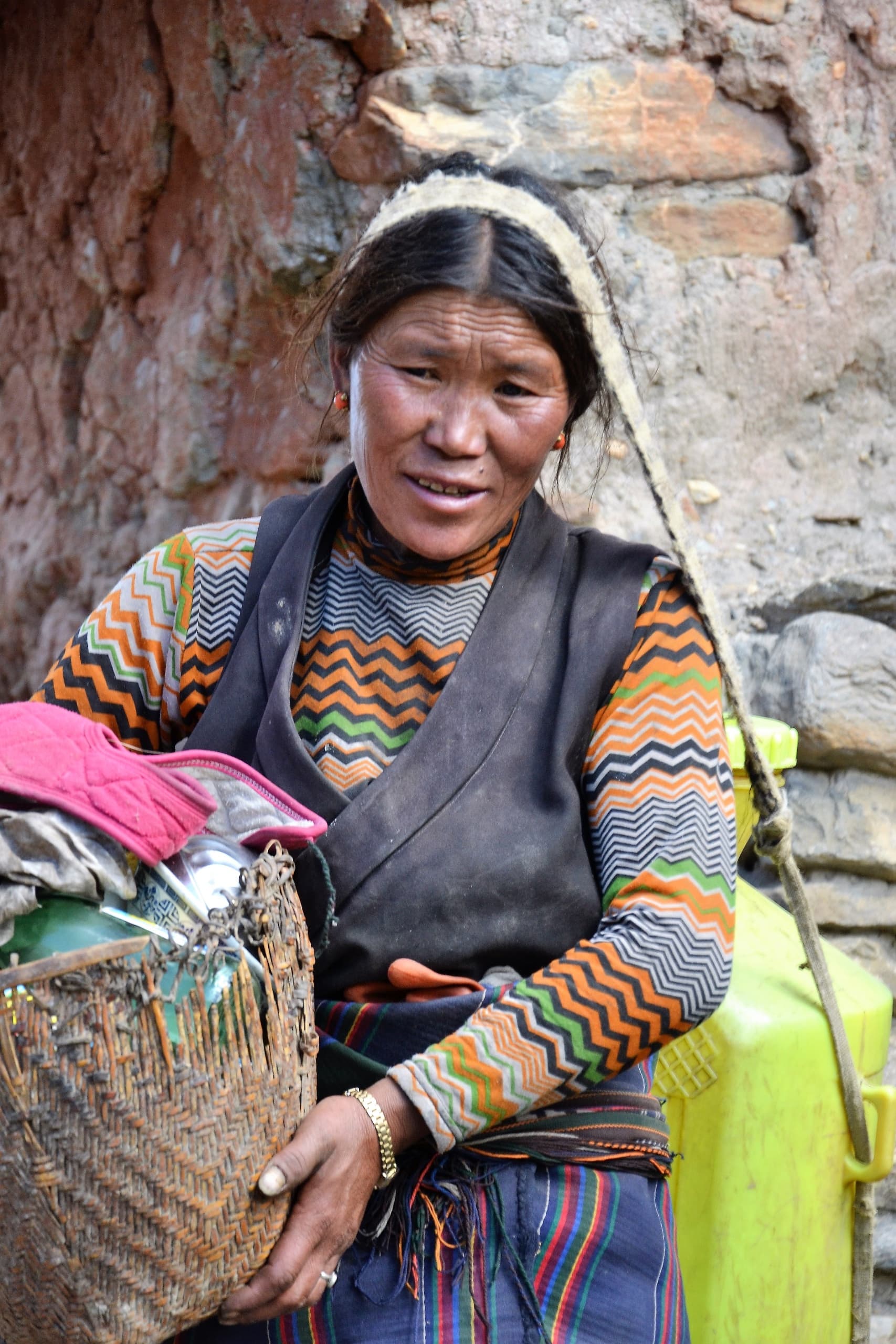
The region is home to communities with distinctive local traditions, including Tibetan Buddhist cultural influences in the upper valleys.
Dress respectfully when visiting monasteries, ask permission before photographing people and religious ceremonies, and follow your guide's advice on local customs. Avoid giving money or sweets directly to children.
- Start walking around 7–8 AM, depending on the route and weather.
- Take a short morning tea break.
- Stop for lunch at a suitable village or lodge.
- Reach the overnight destination by late afternoon when possible.
- Attend an evening briefing with your guide.
- Have dinner early and rest for the following day.
Some high-altitude days require an earlier start and longer walking hours.
Common Questions
It is a strenuous to very strenuous trek involving high altitude, long walking days, remote terrain and basic accommodation. Good fitness and previous trekking experience are strongly recommended.
Allow approximately 25 days for the itinerary outlined here, including arrival, preparation, transport and a contingency day. The actual duration depends on road access, flight schedules and the final route.
Pangpema, the northern base camp area, is approximately 5,143 m. The trek also crosses high passes connecting the northern and southern valleys.
Yes. The route includes Pangpema on the northern side and Oktang, a viewpoint above the Yalung Glacier on the southern side.
The full circuit is better suited to trekkers with previous multi-day trekking experience. Beginners who are very fit may still find the altitude, remoteness and long walking days challenging.
The region has restricted-area regulations. Trekkers must comply with the current permit, guide and group requirements. Junkiri Treks can arrange the required permits and trekking support.
April and May are popular spring choices, while October and early November are commonly favoured in autumn. Snow and weather conditions can still affect the high passes.
Accommodation is mainly in basic teahouses and local lodges. Facilities are more limited at higher elevations, and trekkers should not expect the comfort or services available in larger trekking villages.
Yes. The route reaches above 5,000 m. Proper acclimatisation, steady pacing and prompt reporting of symptoms are essential.
Trekkers must follow the current restricted-area rules and permit conditions. Arrange the trek through an authorised agency and confirm the applicable guide and group requirements before booking.
Connectivity is inconsistent and may be unavailable in remote villages. Do not rely on mobile internet throughout the trek.
Budget for additional drinks, snacks, hot showers, charging, internet where available, tips and unforeseen expenses. The actual amount depends on your spending habits and package inclusions. Junkiri Treks will provide a recommended budget before departure.
Yes. Depending on your available time, you can extend your trip with a stop over to Ilam to explore its tea gardens and sample local tea, or a wildlife safari at Koshi Tappu Wildlife Reserve.
Ready when you are
So ready to start?
Tell us when you'd like to go and we'll shape the route, the pace and the team around you.
